开放分类目录 - 文档列表
共 1109 个文档
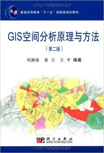
GIS空间分析原理与方法(第2版)
《GIS空间分析原理与方法》(第2版)共分9章。 第1章和第2章探讨了GIS环境下空间分析的基本框架和基础问题; 第3章至第7章主要阐述了空间量测与计算、空间表达变换分析、 空间几何关系分析、空间统计学分析,以及空间三维建模与分析; 第8章介绍了地理网格计算技术及其对GIS空间分析的影响; 第9章结合地理空间数据的不确定性问题,探讨了智能计算技术的基本原理、 方法体系及其应用于地理空间数据分...二级分类: 图书 | 2026-04-30 14:12:26 UTC
国家环境图书馆(美国)
本网站提供了带有摘要的人口与环境数据库,以及所有可获得的关于人类行为对环境影响的在线资料如:文章、数据库、幻灯片演示等的目录信息。此外还有300多种环境期刊的链接和630多种关于环境问题的美国国会研究服务部报告全文。二级分类: 门户网站 | 2026-04-30 14:12:26 UTC
SaltNet网站--一个盐水侵蚀与海岸蓄水层科学资源网站
SaltNet是一个国际性资源网站, 主要提供有关盐水侵蚀与海岸蓄水层研究的资料和信息, 网站资源可以免费使用。网站内容包括:参考书目信息; 计算机编码介绍;相关会议通知、相关网站地址目录表及链接。二级分类: 门户网站 | 2026-04-30 14:12:26 UTC
普通高等教育"十二五"规划教材·21世纪全国高校应用人才培养信息技术类规划教材:空间数据分析
本书可作为地理信息系统、计算机科学与技术、遥感科学与技术、测绘工程、 地理科学等相关专业学生的教科书,同时也适合于从事空间数据分析、 地理信息系统应用的人员参考.二级分类: 图书 | 2026-04-30 14:12:26 UTC
网络地理信息系统的方法与实践
《网络地理信息系统的方法与实践》是作者结合10年(1998-2009) 网络GIS的理论方法探讨、平台软件开发、工程实践和研究生授课所写, 全文共分十一章,五大部分。 部分为概念篇(第1-2章),阐述网络GIS的基本概念、发展历程和相关技术; 第二部分为技术篇(第3-6章),阐述网络GIS的体系结构、构造模式、 数据组织和信息表达;第三部分为产品篇(第7-8章), 阐述流行的国内外Web ...二级分类: 图书 | 2026-04-30 14:12:26 UTC
Lining Up Data in ArcGIS: A Guide to Map Projections
Data misalignment is one of the biggest issues faced by GIS users. As a member of the ESRI support services team, author Margaret Maher has handled more than 12,000 incidents relating to project...二级分类: 图书 | 2026-04-30 14:12:26 UTC
无人机遥感载荷综合验证系统技术
《无人机遥感载荷综合验证系统技术》以国家863计划重点项目 "无人机遥感载荷综合验证系统"研究成果为基础, 系统介绍遥感载荷验证的无人机通用平台、高精度光学载荷、 高精度合成孔径雷达的研制/改造的技术方法,全面阐述面向载荷性能分析的数据二级分类: 图书 | 2026-04-30 14:12:26 UTC
Arc View地理信息系统空间分析方法
《Arc View地理信息系统空间分析方法》 是作者在总结近年来利用ArcView GIS软件进行地学分析研究、工程应用和教学经验的基础上编写而成。全书共分14章,主要内容包括ArcView的功能介绍、 ArcView的空间分析方法、 ArcView的应用实例以及ArcView的空间分析精度研究等。 《Arc View地理信息系统空间分析方法》图表丰富、脉络清晰, 有大量明晰的操作步骤和典型...二级分类: 图书 | 2026-04-30 14:12:26 UTC
普通高等教育"十一五"国家级规划教材•地理信息系统数据库(第2版)
《普通高等教育"十一五"规划教材•地理信息系统数据库(第2版)》全面、 系统地论述GIS数据库的基本原理、应用方法、最新理论与发展趋势, 以及在国土规划与管理、水资源规划与管理等方面的许多应用实例, 所涉及的主要内容和相关关键技术是目前GIS数据库研究与开发最需要考虑的技术问题之一。《普通高等教育"十一五"规划教材•地理信息系统数据库(第2版)》共七章, 内容包括:绪论;空间数据的表达与管理...二级分类: 图书 | 2026-04-30 14:12:26 UTC
地理信息系统专业英语
《地理信息系统专业英语》是面向高等院校的地理信息系统本科专业和 地图学与地理信息系统硕士研究生专业开设的专业英语教程。 全书共分16个单元,整体内容分为GIs概念、GIS技术和GIS应用三大部分。 每个单元包含Text,Newr words,Phrases,Notes,Exerclses, Tramlatlon co Text and Key to Exerclses等内容, 便于教师授课和...二级分类: 图书 | 2026-04-30 14:12:26 UTC
Imagery and GIS: Best Practices for Extracting Information from Imagery
The basis for most maps is imagery. Imagery and GIS: Best Practices for Extracting Information from Imagery shows how imagery can be integrated successfully into maps and GIS projects. Readers ...二级分类: 图书 | 2026-04-30 14:12:26 UTC